The oldest continuously occupied port on the Levantine coast, and the city whose name the Greeks borrowed for papyrus — and then for the book itself.
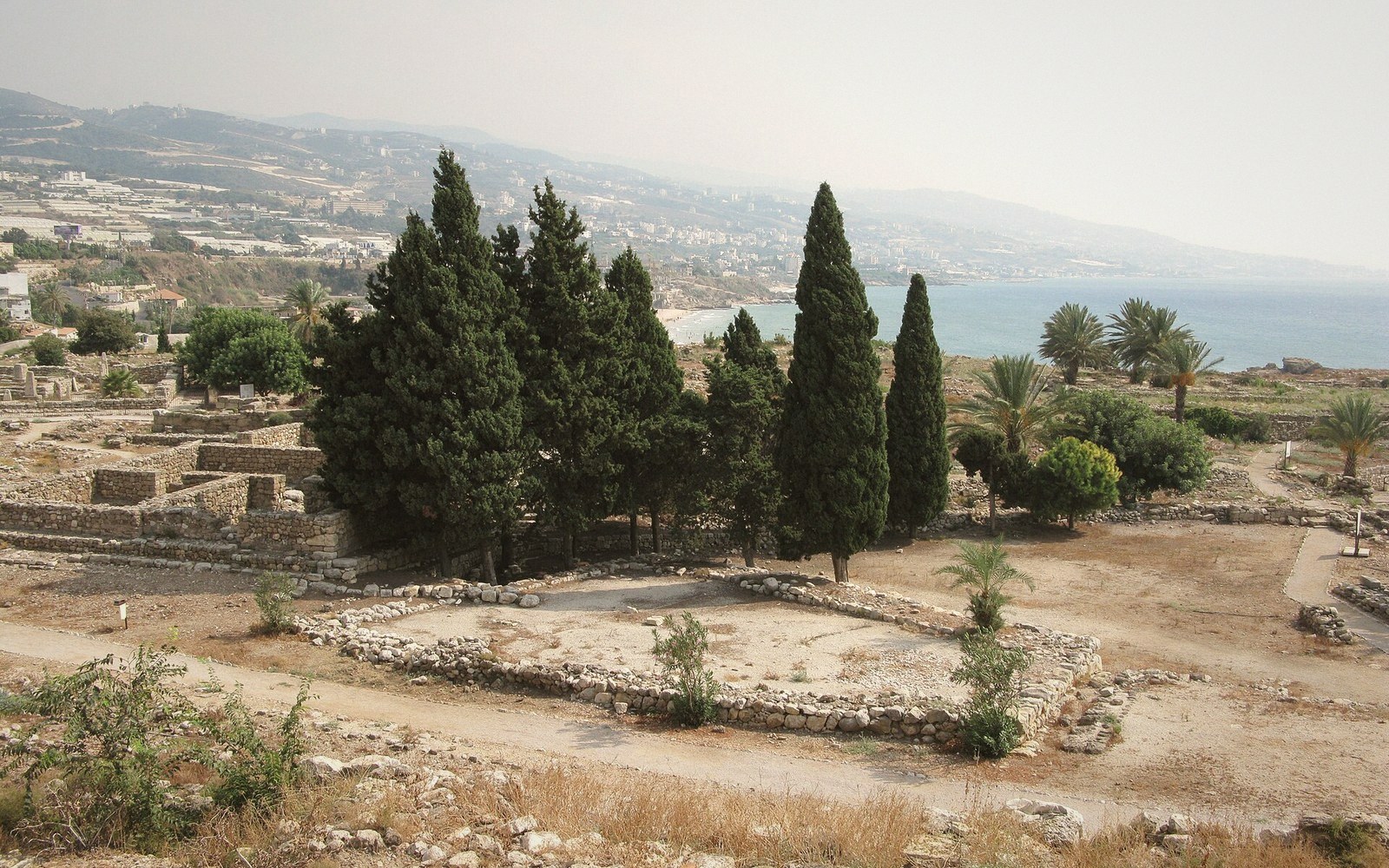 PLATE 1
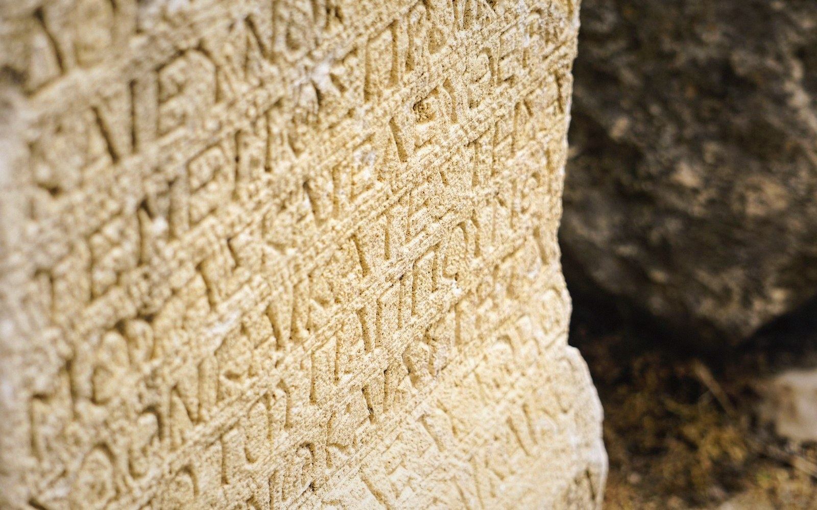 PLATE 2
The Site and Its Sequence
Byblos sits on a low limestone headland above the eastern Mediterranean, roughly 37 kilometres north of Beirut (34.1213° N, 35.6488° E). The site's Arabic name is Jubayl; its Phoenician name was Gubla or Gebal. Occupation runs from at least the Neolithic period through the Bronze Age city-states, the Egyptian, Assyrian and Persian periods, the Hellenistic and Roman towns, Byzantine settlement and medieval Crusader construction, all compressed into the same mound. It is, by any honest accounting, one of the densest stratigraphic columns in the ancient world.
The Egyptian connection defines the Bronze Age city. From roughly the third millennium BCE, Byblos exported cedar — felled in the Lebanon range a day's journey inland — to a timber-poor Nile valley. In return, Egyptian luxury goods flooded the port: faience vessels, gold work, alabaster jars. The city's elite burials reflect both: local craftsmanship alongside Egyptian imports, a material record of a relationship sustained across centuries. Egyptian inscriptions at Byblos invoke Hathor as the city's presiding deity, a sign of how deeply that exchange had become ritual as well as commercial.
The city's Greek name, Byblos, entered Mediterranean vocabulary because Egypt shipped its papyrus through this port. The Greeks called papyrus byblos after the entrepôt, and the diminutive biblion — a papyrus sheet, then a rolled document — gave the Western tradition the root it still carries in bibliography, Bible and bibliothèque.
 PLATE 3
The Excavations
Ernest Renan visited Byblos in the 1860s as part of the Mission de Phénicie, the French government survey of the Levantine coast, and cleared some material, though by the standards of later archaeology his methods were rough. Systematic excavation began in 1921 under Pierre Montet of the University of Strasbourg, who uncovered royal tombs cut into the rock beneath the tell — a tell being the accumulated debris of superimposed occupation layers. Montet's successor, Maurice Dunand, took over in 1926 and dug at Byblos for five decades, producing a stratigraphic record of unusual depth.
The royal tombs Montet opened are the site's most celebrated find-group. Nine shaft tombs, cut into bedrock and dated broadly to the Middle Bronze Age, held the burials of local rulers alongside Egyptian-style gold pectorals, obsidian vessels and, in one case, a sarcophagus in Egyptian form bearing a hieroglyphic inscription naming the occupant as Abi-Shemu, a king of Byblos. The objects moved to the National Museum of Beirut, where many remain.
The Ahiram Inscription and the Alphabet
Among the tombs Montet cleared was one belonging to Ahiram, a local ruler whose sarcophagus carries a Phoenician inscription dating to around the tenth or eleventh century BCE — one of the earliest substantial Phoenician texts known, and one whose letter-forms are recognisably ancestral to Greek and Latin script. The Ahiram sarcophagus is now in the National Museum of Beirut. Its inscription is a curse against tomb violators, written in a linear alphabet that had, by that point, already shed the pictographic weight of its proto-Sinaitic ancestors and settled into the stripped, consonantal system that would travel west with Phoenician traders.
Byblos also produced a set of earlier inscriptions, sometimes called Pseudo-hieroglyphic or Proto-Byblian, which remain undeciphered. Their relationship to Phoenician proper is debated; they may represent an independent or transitional writing system, or something else entirely. The decipherment problem has attracted repeated attempts since Dunand published the texts in the mid-twentieth century, none conclusive.
What Survives Above Ground
The tell today is an open archaeological park. Crusader walls built from reused ancient masonry ring part of the site; a twelfth-century CE castle stands near the harbour. Visible on the ground are the foundations of Bronze Age temples — the Temple of Baalat Gebal (Lady of Byblos) and the so-called L-shaped Temple — alongside Hellenistic and Roman colonnaded streets. The layers are literally on top of one another: Roman column drums cut from Phoenician-period stones, medieval mortar filling Bronze Age wall-joints. At Byblos the archive is the city itself.
Related entries